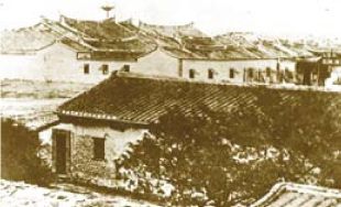
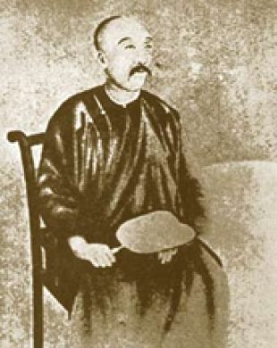
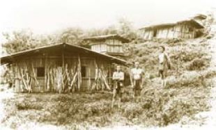
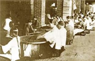
The name of Taipei first appeared between the end of Kangxi period and the beginning of Yongzheng period. In the Chu Qian Pu Record by Lan, Dingyuan, he described that: “Chu Qian Pu, with width of several hundred Lis, no people traces in one-day waling. Savages appeared here which terrify passing people, calling it a dangerous road. However the county is the only way passing the Danshui River, with rich flat plain, which can be cultivated thousands of hectares of farm lands. The greater benefits of『Taipei 』people are most on it. “The Taipei here means the north area of Chu Qian (now Xinzhu City), the northern Taiwan area. In the first year of Guangxu period of the Qing Dynasty (1875), Shen, Baozhen, the imperial envoy, established the Taipei government, ruling over the area covering Monga (the general name of the main districts of Taipei City at that time) and established the Taipei government office (now in Chungcheng District), Taipei has become an administrative region. In the 10th year of Guangxu period (1884), Taipei city has completed construction. After Taiwan became a province, the first Taiwan governor was Liu, Mingchuan, who took the Taipei city as the office premise, mainly constructing the city and Dadaocheng area and making them the core areas of Taipei city with Monga, collectively called the three city streets. In the Japan-ruled period, the governor issued the administration distribution system. In 1920, according to the administration system, Taipei was set as a municipality directly under the state, and the Taipei city office was established. The name of Taipei City has officially appeared. Taipei City is located at the center of the Taipei basin of northern Taiwan. According to geological assumptions, in ancient times, Taipei basin was a large lake; after thousands of years’ deposition, the basin formed. In the travel in Bi Sea by Yu, Yonghe, he has described that, "entering Guandu gate, there is a large lake widely inundating, seems no limits. After several lis walking, mountains surrounding for hundreds lis, inside of these, it’s a plain." This phase is exactly what is described here. The Taipei basin, before cultivated by Han people, was the home of aborigines of Ketagalan Tribe, who made their living by gathering, fishing, hunting and shifting cultivation. Ketagalan Tribe was a branch of the Pingpu Tribe which is distributed in the north of Taiwan. Their gathering places stretch from what is now Taoyuan, ending at the north of Santiago and Yilan areas. Their scattered places were in Keelung, Danshui, Taipei and other places. According to the hypothesis from Japanese scholar Kanori Ino, Ketagalan Tribe moved west after formation of the Santiago tribe, along the coast passing Keelung, Jinbaoli, Cape Fukuei and Hobe, migrated along the Keelung river entering Taipei basin, in Sijhih area called Kypanas, in Songshan area called Malotsigauan, near the Dadaocheng area called Kipon, near the Dalongdong area called Daronpon and also crossing Xindian Creek formed Pái-chiap and Xiulang, which are the earliest inhabitants in record in Taipei basin. Indigenous people groups include Amis, Tayal, Payuan, Bunun, Rukai, Puyuma, Tsou, Saisiyat, Yami(Tao), Thao, Kebalan, Truku, Sakizaya, Seediq, Hlaalua and Kanakanavu. Until 2014, the indigenous population in Taipei City is 15,581, most of them from the Amis and Hlaalua and Kanakanavu with a smaller population, and most of them living in Neihu, Wenshan and Nangang District which are in suburban area. In the 22th year of Kangxi period (1683), Taiwan added to the Qing dynasty landscape; the following year, Taiwan government was established, ruling Zhulong, Taiwan and Fengshan counties; since then migrants from Fujian and Guangdong increased. In the 48th year of Kangxi period (1709), after Chen, Laizhang, the leader of cultivation group applied for cultivating the Tagala area (now the area of Monga, Xinzhuang and Dalongdong), Han migrants to the north increased. During the period of Qianlong of Qing Dynasty, the Monga area in the meeting area of Xindian Creek and Danshui River starting with the potato street (named for Han people trading potatoes with aborigines) grew into the political, military and business center; and in the period of Jiaqing, becoming the third largest city in Taiwan leading to the saying, “First Tainan, second Lugang, third Monga.“ During the Tongzhi period, (1862 - 1874), because of the tea trade rising in Dadaocheng, the tea in Taipei became famous in international market. By the 10th year of Guangxu period, (1884) Taipei has been established as a city; in 13th year of Guangxu period (1887), Taiwan had become a provincial administration. The first Taiwan governor Liu, Mingchuan made a planned construction of Taipei city, building railways, setting streets, opening schools, and taking the Taipei city as the office premise, Dadaocheng as the trade area, and the area surrounding what is now Guide Street as the residences for foreigners. This city planning is the basis of the development of Taipei City today. After Japan occupied Taiwan in the 21th year of Guangxu period (1895), the Japan set Taiwan government in Taipei city. In 1899 – 1901, Japanese performed road extension and gutterway improvement in Taipei city. In 1905, Japanese tore down the Taipei office which was established at the end of the Qing Dynasty; transferring the foundation to roads, connecting with the three streets of Monga, city and Dadaocheng, expanding of the administrative region of Taipei. In 1920, they established Taipei as a municipality directly under the state, and the administrative region expanded beyond the three streets, now also including the eastern districts, such as Da’an, Zhonglun and Songshan. After Taiwan's retrocession in 1945, Taipei City was designated as a province-governed municipality. In October, the city office established in Japan-ruled period was abolished; a city government established with 10 administrative districts; comprised of the lower administrative unit of village and further lower neighbor. In 1949, the central government moved to Taiwan; and in 1950 the autonomy of county and city has been implemented. Taipei City held elections for city councilors for the first time, establishing the city council which laid the foundation of democratic politics. In December 31, 1966, because Taipei City was the wartime capital and the political, military, cultural and economic center, the central government decided to designate Taipei as a municipality directly under the central government, issued by the president in July 1, 1967. Meanwhile the Jingmei, Mushan, Nangang, Neihu, Shilin, and Beitou suburban areas were add to the administrative region of Taipei City, bringing Taipei City to 16 administrative districts. In March 12, 1990, there was another reorganization of the on administrative regions of Taipei City into 12 administrative districts, including Datong, Chungcheng, Wanhua, Zhongshan, Shilin, Beitou, Songshan, Nangang, Neihu, Xinyi, Da’an and Wenshan districts, maintained to the present.1. Origin of the Name of Taipei City
2. Home of Ketagalan people
3.From Netherlands and Spain to Zhenghe in Ming Dynasty
4. Developing business in the Qing Dynasty
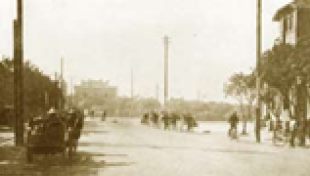
5. Infrastructure in Japan-ruled period
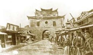
6. Developing vigorously after retrocession
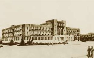
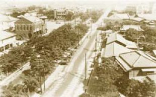

![Taiwan.gov.tw [ open a new window]](/images/egov.png)
